The landscape concept includes the central area around the Main Wall, the Kovirke Wall, the North Wall and the Krum Wall. It includes parts of the ancient army road, historic forts and redoubts, the drained former Dannevirke Lake, as well as the central archaeological park at Danevirke Museum, where, among other things, Valdemar's Wall from the 12th century, Wiglesdor (the Gate to the North) and a cannon redoubt from the Schleswig Wars are important attractions.
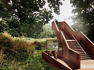
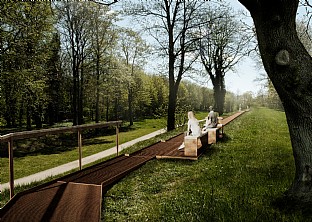
By creating new looped walkways that connect the site's many highlights, visitors are guided to entirely new experiences, while accessibility is increased, and the archaeological substance is protected from wear and tear. This will be achieved in part through raised Corten steel paths, stairs and platforms on or over the most sensitive parts of the monument and the natural environment.
Strengthening the communication of history
The walks in the archaeological park lead through the Gate to the North, over and up onto the rampart itself, and at the remains of the Valdemar's Wall, a new freely cantilevered viewing platform allows visitors to experience the original height and impact of the fortification in the landscape without touching the historic brickwork.
At the reconstructed Redoubt 14, an information pavilion will be integrated, and in other places along the extensive fortifications, information points will be set up which illustrate the design of the wall through different historical eras, supplemented with seating options.
In addition to the upgrading of the archaeological park, the wider landscape concept places emphasis on enhancing the natural values of the area, for example by creating a new wetland area at Dannevirke Lake, and on improving activity areas, recreation facilities and meeting points such as playgrounds and festival areas for the local community to use all year round.


